The bike I rented was great but very different than what I'm used to. I ride a Surly Krampus mountain bike which has wide tires but no suspension so there's a certain way to ride over obstacles. The bike I had was a full suspension bike with a dropper post. It only cost $65 to rent and as I signed the rental agreement felt like I should have read it a little more closely since it was a $3,500 bike!

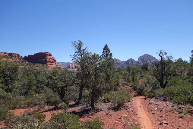
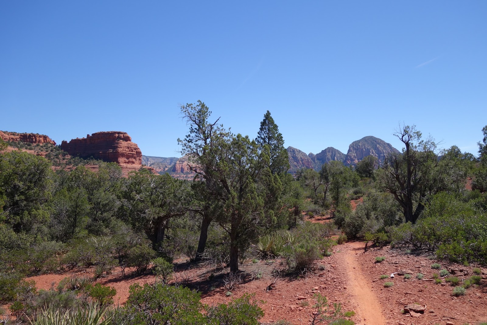
I rode a combination of the West Sedona Loop and the Chuckwagon - Mescal - Long Canyon Loop. These incorporate about twelve trails in the Sedona area. I would have gotten completely lost had it not been for the eTrex since all I had to do was follow a line on the GPS. The trails criss-cross each other a lot but are still marked well. For a one day excursion I was ok with relying on the GPS versus studying the maps and area a little more.
The trails were incredibly rocky, technical, beautiful, etc., etc. I walked a decent amount since there was no way I was dropping straight down over jagged rocks. Or in some of the slick rock sections if I had fallen I would have tumbled several hundred feet and the last time I checked that would hurt.

Red dirt everywhere!


The picture doesn't do it justice but that was straight down and rocks everywhere throwing the bike around. I walked down that section.


Deadman Pass...not a sign I was excited to see.


I only got stuck a few times by all the cactus plants!


Chimney Rock...kinda.


When my only two options were "difficult" and "extreme" I figured I would do a lot of walking, which I did.

Some people were out hiking and taking pictures and they took a picture for me. This was the main slick rock section of the ride and at times the trail as right on the ledge. I didn't risk it since the margin of error was pretty small. But incredibly beautiful.

After a while this picture pretty much described how I felt. Thinking the "intermediate" route would be in my ability level was pretty foolish. It was one of the hardest rides I ever did and I had to cut the route early and did 15 miles but it took nearly five hours! As I learned, that's not too uncommon. It's not easy riding but the views and challenge was extremely worth it.


My handy eTrex and cycling computer!
I wore my GoPro again this time and while it doesn't include all the time I walked and pushed my bike it shows a lot of the easier parts! Until next time...

I rode a combination of the West Sedona Loop and the Chuckwagon - Mescal - Long Canyon Loop. These incorporate about twelve trails in the Sedona area. I would have gotten completely lost had it not been for the eTrex since all I had to do was follow a line on the GPS. The trails criss-cross each other a lot but are still marked well. For a one day excursion I was ok with relying on the GPS versus studying the maps and area a little more.
The trails were incredibly rocky, technical, beautiful, etc., etc. I walked a decent amount since there was no way I was dropping straight down over jagged rocks. Or in some of the slick rock sections if I had fallen I would have tumbled several hundred feet and the last time I checked that would hurt.

Red dirt everywhere!


The picture doesn't do it justice but that was straight down and rocks everywhere throwing the bike around. I walked down that section.


Deadman Pass...not a sign I was excited to see.


I only got stuck a few times by all the cactus plants!


Chimney Rock...kinda.


When my only two options were "difficult" and "extreme" I figured I would do a lot of walking, which I did.

Some people were out hiking and taking pictures and they took a picture for me. This was the main slick rock section of the ride and at times the trail as right on the ledge. I didn't risk it since the margin of error was pretty small. But incredibly beautiful.

After a while this picture pretty much described how I felt. Thinking the "intermediate" route would be in my ability level was pretty foolish. It was one of the hardest rides I ever did and I had to cut the route early and did 15 miles but it took nearly five hours! As I learned, that's not too uncommon. It's not easy riding but the views and challenge was extremely worth it.


I wore my GoPro again this time and while it doesn't include all the time I walked and pushed my bike it shows a lot of the easier parts! Until next time...